1 - 6 of 6
Number of results to display per page
Search Results
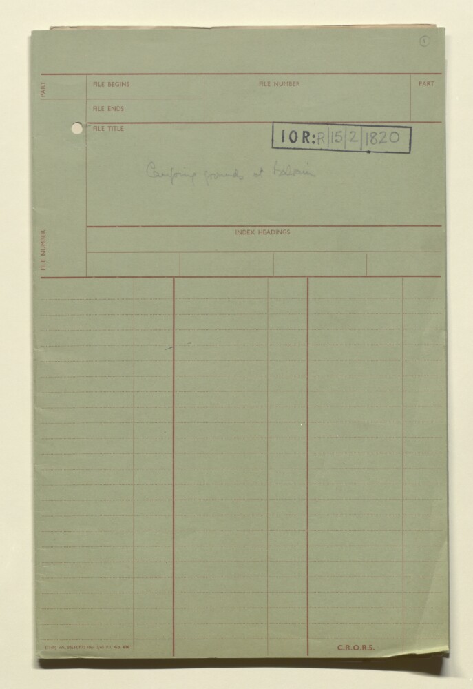
1. ‘Camping grounds at Bahrain’
- Description:
- Abstract: The file comprises maps and notes prepared in anticipation of the stopping off at Bahrain of Indian Army regiments that were part of Indian Expeditionary Force D, which travelled from Bombay to Basra in October 1914, and went on to fight in the Mesopotamian campaign of the First World War. The regiments stopped at Bahrain between 23 and 30 October 1914. However, in spite of the preparations made, no troops or livestock left the Expeditionary Force ships which moored off the Bahrain coast.The file contains:three hand drawn maps (one original and two tracings) showing the proposed sites for camps, and planned routes for infantry and animals from the selected disembarkation points in Manama, to the camps (ff 4-5, ff 6-8, ff 9-11);a carbon-copied sketch map of a camp, located one mile south of Manama, with allocated plots within the camp for different regiments, many of which were part of the 6th (Poona) Division (f 3);a general note entitled ‘camping grounds in Bahrain Island’ (f 2);disembarkation notes, identifying the customs jetty, Political Agency jetty, and the Gray Paul & Company jetty, as the three points where disembarkation could take place (ff 12-13);a note on the availability of drinking water in Bahrain, including surface wells, deep wells, sea springs and island springs (ff 14-15);further notes on the two possible camping grounds identified (ff 16-18);a note on supplies, with brief details of fuel and fodder (f 19);notes for the ADMS [Assistant Director of Medical Services] on the climate and sanitary situation at Bahrain (f 20);duties of various people who would be involved in the disembarkation and supply of provisions (f 21).Physical description: Foliation: the foliation sequence commences at the front cover with 1 and terminates at the inside back cover with 22; these numbers are written in pencil, are circled, and are located in the top right corner of the recto side of each folio.
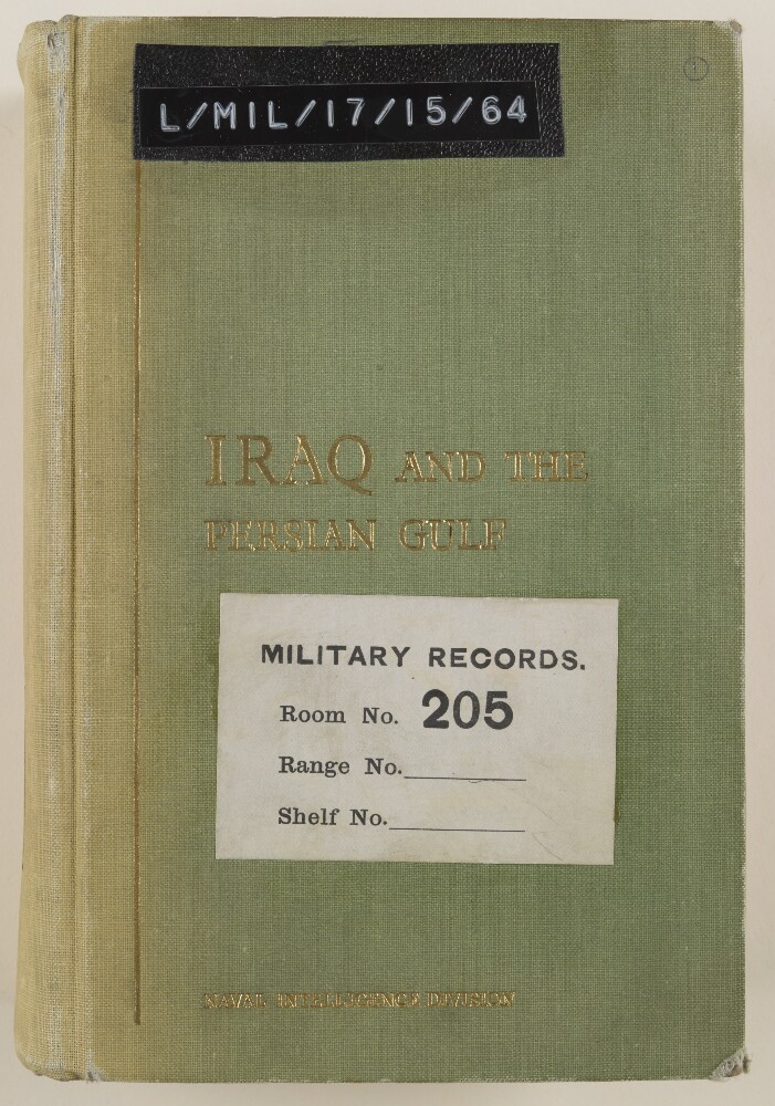
2. 'IRAQ AND THE PERSIAN GULF'
- Description:
- Abstract: The volume is titled Iraq and the Persian Gulf(London: Naval Intelligence Division, 1944).The report contains preliminary remarks by the Director of Naval Intelligence, 1942 (John Henry Godfrey) and the Director of Naval Intelligence, 1944 (E G N Rushbrook).There then follows thirteen chapters:I. Introduction.II. Geology and description of the land.III. Coasts of the Persian Gulf.IV. Climate, vegetation and fauna.V. History.VI. People.VII. Distribution of the people.VIII. Administration and public life.IX. Public health and disease.X. Irrigation, agriculture, and minor industry.XI. Currency, finance, commerce and oil.XII. Ports and inland towns.XIII. Communications.Appendices: stratigraphy; meteorological tables; ten historical sites, chronological table; weights and measures; authorship, authorities and maps.There follows a section listing 105 text figures and maps and a section listing over 200 illustrations.Physical description: Foliation: the foliation sequence (used for referencing) commences at the front cover with 1, and terminates at the inside back cover with 430; these numbers are written in pencil, are circled, and are located in the top right corner of the recto side of each folio.Pagination: the file also contains an original printed pagination sequence.
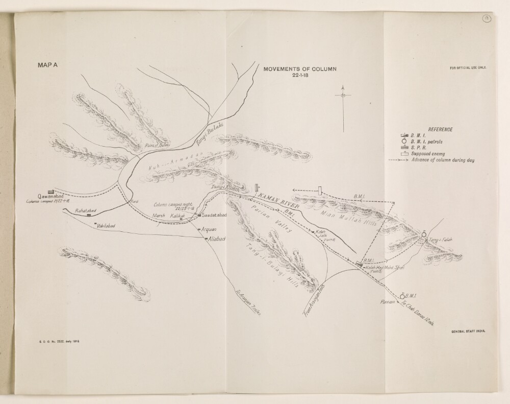
3. 'MOVEMENTS OF COLUMN 22-1-18'
- Description:
- Abstract: The map shows the column movements of the Burma Mounted Infantry and the South Persia Rifles in the region of Saadatabad [Saʻādatābād], Fars, Persia, on 22 January 1918. It is found in the Despatch by Brigadier-General Sir P. M. Sykes, K.C.I.E., C.M.G., Inspector-General, South Persia Rifles and Commanding British Mission Escort in Persia on Minor Operations in Southern Persia. From 7th November 1917 to 31st March 1918.It includes the following reference key: B M I [Burma Mounted Infantry]; B M I patrols; S P R [South Persia Rifles]; supposed enemy; and advance of column during the day.The map is stamped 'General Staff India', and includes a printing statement which reads 'S. D. O. No. 2332. July 1918.'.Physical description: Materials: Printed on paperDimensions: 337 x 427mm
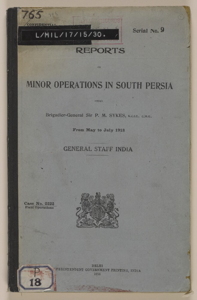
4. 'REPORTS ON MINOR OPERATONS IN SOUTH PERSIA UNDER Brigadier-General Sir P. M. Sykes, K.C.I.E, C.M.G., from May to July 1918. GENERAL STAFF INDIA'
- Description:
- Abstract: The volume consists of reports on minor military operations in 'South Persia' contained in a despatch from the Inspector General, South Persia Rifles (Percy Molesworth Sykes) to the Chief of the General Staff, Army Headquarters, Simla. The reports recount operations against Labu Muhammadis, Chehar Radis and other 'robber tribes' of 'Northern Fars' and against the 'Saulat-ud-Daulah', Il Khani of the Qashqais', and 'Nasr-I-Divan Kalantar of Kazarun'. Many of the reports included were by the Deputy Inspector General, South Persia Rifles (Colonel Ernest Frederick Orton).There follow individual reports from commanding officers detailing the units involved, topography of the land on which the military operations took place, the villages and tribes attacked, description of military operation, tables of operational logistics and casualties sustained on both sides.The volume contains 17 maps and plans of the towns and villages attacked in the operations, giving such information as relief, settlement, hydrology, lines of communication and progress of battle:'Plan of villages - CHAH-HAQ and MIAN DASHT, CHAHAR-RAHI PUNITIVE EXPEDITION. APRIL, 1918' (folio 4)'ACTION OF DEH SHAIKH. 25th May 1918.' (folio 15)'Fight at DEH SHAIKH Map (17. C. B. 2.4.6) 25th May 1918.' (folio 17)'ACTION OF DEH SHAIKH. 25th May 1918. Decisive attack from Gardaneh Sagavi Kutal, 3 p.m.' (folio 18)'PLAN OF NEIGHBOURHOOD SHIRAZ' (folio 23)'AFIFABAD POST As when occupied by detachment on 9-6-18.' (folio 24)'Action of BULVARDI, near SHIRAZ. June 27th 1918.' (folio 30)'Action at CHINARINAZ (10th May 1918)' (folio 39)'ACTION NEAR HERAT-I-KHURREH' (11th May 1918) GUDAR-I-PIRZAD.' (folio 41)'PLAN SHEWING HILLS SOUTH OF ZIARAT VILLAGE.' (folio 43)'ACTION OF ZIARAT, SARCHAHAN VALLEY; 13-5-1918. From Khunsar River (folio 44)'ACTION OF KUH-I-KHAN. Against Charrahis 16-5-1918. From hill 1200 feet above , and N. of valley; looking South.' (folio 47)'ACTION OF CHINAR RAHDAR. 7th July 1918. Situation at 5-30 a. m., 7th July 1918.' (folio 61)'SKETCH MAP OF ABADEH.' (folio 74)'Sketch Map to Illustrate OPERATIONS TOWARDS FIRUZABAD (July 1918.)' (folio 82)'PERSIA. INDIA AND ADJACENT COUNTRIES. SHEET NO. 17' (folio 84)'ACTION NEAR FIRUZABAD. [23rd-24th July 1918].' (folio 85)Physical description: Foliation: the foliation sequence for this description commences at the front cover with 1, and terminates at the inside back cover with 87; these numbers are written in pencil, are circled, and are located in the top right corner of the recto side of each folio. Pagination: the volume also contains an original printed pagination sequence.
5. 'REPORT on the Working of the Line of Communication AND ON THE Withdrawal of the British Military Mission IN EAST PERSIA, 1919-20. GENERAL STAFF INDIA.
- Description:
- Abstract: The volume is titled Report on the Working of the Line of Communication and on the Withdrawal of the British Military Mission in East Persia, General Staff India. The volume is marked confidential and was printed in Delhi by Superintendent Government Printing, India, in 1921.The report is from the General Officer Commanding, Baluchistan District to the Chief of the General Staff; the report contains preliminary remarks on 'The withdrawal of the troops of the British Military Mission at and beyond Meshed, and of the Lines of Communication'. There follows the substantive report from the Inspector-General of Communications, East Persia, Duzdap to the General Staff, Baluchistan District, Quetta. This report is divided into two parts:Part I - 'A brief report on the working and organization of the Line of Communications, East Persia, in April 1920'Part II - 'The withdrawal' which has the following sub-sections: general; supply and transport services (including some special points for consideration); medical; ordnance; works; posts and telegraphs; vetinary.The report is accompanied by nine maps:'APPENDIX 1. SKETCH MAP SHOWING POSITION OF POST AND COMBINED OFFICES IN EAST PERSIA' (folio 10)'APPENDIX 1. L. OF C.E.P. INTELLIGENCE SYSTEM' (folio 12)'APPENDIX 2. AREA ON THE EAST PERSIA L. OF C. COMMON TO RAIDING (folio 15)'APPENDIX 1. GRAPHIC MAP ILLUSTRATING THE NORMAL SOURCES FROM WHICH THE TROOPS IN EAST PERSIA WERE SUPPLIED AND THE CONTINUOUS MOVEMENTS BY WHICH THE SUPPLIES WERE NORMALLY DISTRIBUTED TO THE FORCE AT MESHED AND TO THE GARRISONS OF POSTS ON L. OF C.' (folio 18)'APPENDIX 1. LINES OF COMMUNICATION EAST PERSIA' (folio 33)'APPENDIX 3. DIAGRAM SHOWING POSITIONS OF TELEPHONE, TELEGRAPH AND COMBINED OFFICES IN EAST PERSIA' (folio 35)'COLUMNS AND CONVOYS WOKRING IN CONNECTION WITH WITHDRAWAL FROM EAST PERSIA' (folio 55)'DAYS AFTER ZERO' (folio 62)'PLAN showing ORGANIZATION OF LINE OF COMMUNICATIONS (ADMINISTRATIVE AND DEFENCE TROOPS) (folio 77)Physical description: Foliation: the foliation sequence for this description commences at the front cover with 1, and terminates at the inside back cover with 78; these numbers are written in pencil, are circled, and are located in the top right corner of the recto side of each folio.Pagination: the volume also contains an original printed pagination sequence.
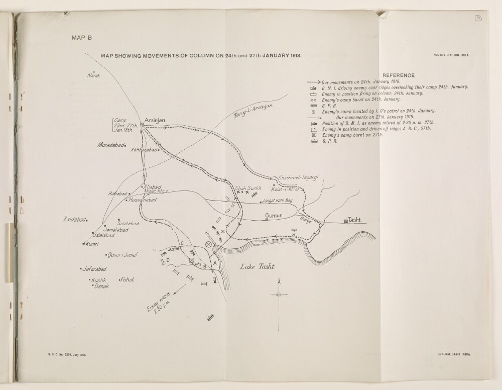
6. 'MAP SHOWING MOVEMENTS OF COLUMN ON 24th and 27th JANUARY 1918'
- Description:
- Abstract: The map shows the column movements of the Burma Mounted Infantry and the South Persia Rifles in the region between Arsinjan [Arsanjān] and Lake Tasht [Daryācheh-ye Ţashk], Fars, Persia, on 24 and 27 January 1918. It is used to accompany the Despatch by Brigadier-General Sir P. M. Sykes, K.C.I.E., C.M.G., Inspector-General, South Persia Rifles and Commanding British Mission Escort in Persia on Minor Operations in Southern Persia. From 7th November 1917 to 31st March 1918.It includes the following reference key: B M I [Burma Mounted Infantry]; S P R [South Persia Rifles]; troop movements; and the position and camps of the enemy.The map is stamped 'General Staff India', and includes a printing statement which reads 'S. D. O. No. 2334, July 1918.'.Physical description: Materials: Printed on paperDimensions: 337 x 430mm