Abstract: The file contains correspondence regarding a request by Petroleum Concessions Limited to be allowed to survey areas of the Aden Protectorate for oil exploration purposes.The file includes a formal request received from the company, plus details of a meeting held between a company representative and the Aden Chief Commissioner, Bernard Reilly. This includes details of the areas of the Protectorate to be visited; the anticipated means of travel; a request for assistance from the Royal Air Force; the type and duration of exploration license to be granted; and a request that the exploration party be granted the status of formal Government survey party.The file also contains correspondence between the Aden Chief Commissioner, the Air Council, and the Foreign Office, regarding the potential difficulties of according the expedition the status of a formal Government survey party (they wished to avoid setting a precedent). The Foreign Office suggest that the Government of Aden appoint their own surveyor to conduct a survey on behalf of Petroleum Concessions Limited, and that the company's exploration team could then informally accompany the Government surveyor.The file includes a divider which gives a list of correspondence references contained in the file by year. This is placed at the end of the correspondence (folio 1).Physical description: Foliation: the foliation sequence commences at the front cover with 1 and terminates at the inside back cover with 27; these numbers are written in pencil, are circled, and are located in the top right corner of the recto side of each folio.
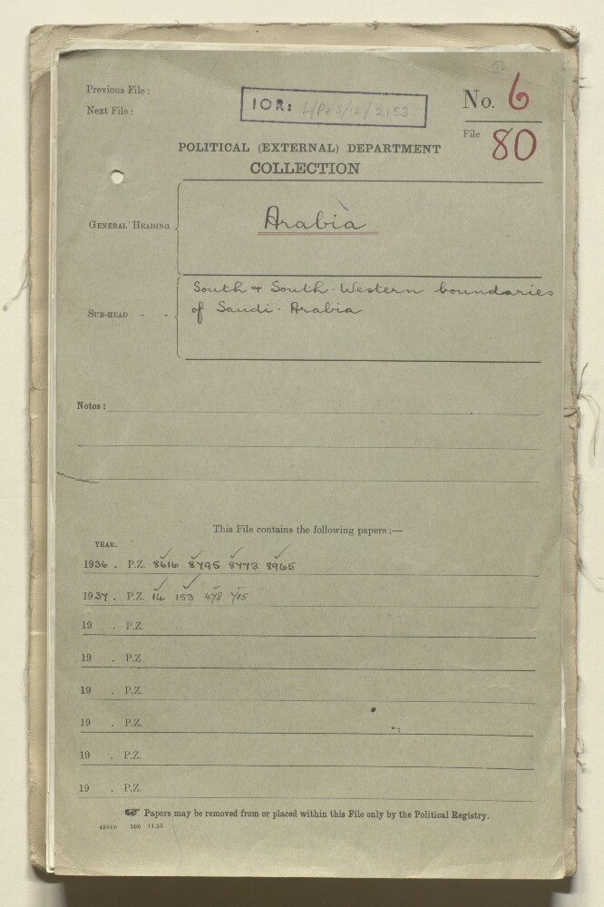
Abstract: This file relates to the disputed south and south-western boundaries of Saudi Arabia. It primarily concerns an expedition to southern Saudi Arabia that was undertaken by Harry St John Bridger Philby in 1936, during which Philby was reported to have entered Yemeni and British territory. Much of the correspondence discusses Philby's visit to Shabwa [Shabwa, Yemen] (reportedly with an armed Saudi party), a visit considered by the British to be an incursion into the Aden Protectorate.The file's principal correspondents are the following: His Majesty's Minister at Jedda (Sir Reader William Bullard); the Acting Political Resident, Aden (Morice Challoner Lake); Harry St John Bridger Philby; the Minister for Saudi Foreign Affairs [Fayṣal bin ‘Abd al-‘Azīz Āl Sa‘ūd]; the Sultan of Shihr and Mukalla; the Imam of Yemen [Yaḥyā Muḥammad Ḥamīd al-Dīn].In addition to correspondence the file includes Philby's own account of his visit to Shabwa, in an article published in
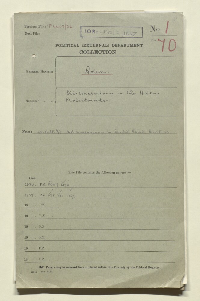
The Timesin January 1937.The file includes a divider which gives a list of correspondence references contained in the file by year. This is placed at the back of the correspondence.Physical description: Foliation: the foliation sequence (used for referencing) commences at the front cover with 1, and terminates at the inside back cover with 70; these numbers are written in pencil, are circled, and are located in the top right corner of the recto side of each folio.
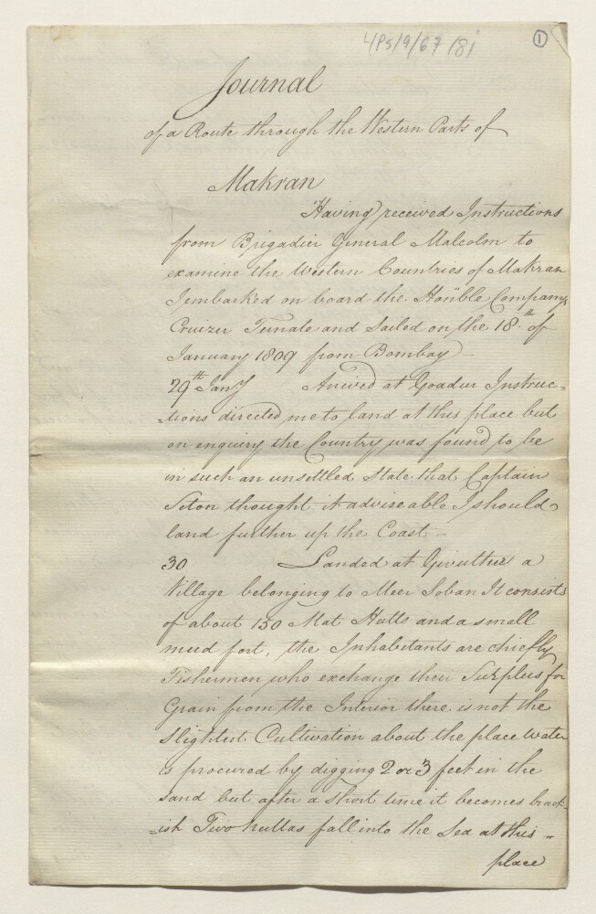
Abstract: A copy of the journal of a route through Makran [Makrān] to Bunder Abbass [Bandar-e ‘Abbās] taken by Captain Grant of the Bengal Native Infantry between 29 January and 28 April 1809, as part of a series of route surveys on the frontiers of Persia ordered by Brigadier-General John Malcolm.The journal describes the roads, settlements, resources, revenues, local populations and chiefs along the route and assesses the threat of a European army reaching India from this direction.The journal was enclosed in Brigadier-General Malcolm’s dispatch to the Chairman of the Court of Directors of the East India Company, received in July 1810 (IOR/L/PS/9/67/80).Physical description: 1 item (16 folios)
Abstract: A printed map to illustrate the route through Makran [Makrān] taken by Captain Grant of the Bengal Native Infantry between 29 January and 28 April 1809, as part of a series of route surveys on the frontiers of Persia [Iran] ordered by Brigadier-General John Malcolm. Covers a coastal area of approximately 330 miles between Gwutter [Gavāter] and Bunder Abas [Bandar-e ‘Abbās], and portrays Grant’s route, settlements, hydrology, and relief.The map was enclosed in Brigadier-General Malcolm’s despatch to the Chairman of the Court of Directors of the East India Company, received in July 1810 (IOR/L/PS/9/67/80).Physical description: Materials: Manuscript; black ink on paperDimensions: 610 mm x 365 mm, on sheet 650 x 420 mm
Abstract: This file contains a document entitled 'The Musandam Peninsula: its people the Shihuh and their dialects' written by Bertram Thomas, Adviser to the Sultan of Muscat.This document contains Thomas's description of the settlements, traditions and customs of the Shihuh tribe of the Musandam Peninsula which he divides into three groups: 'the interior mountain Baduin [Bedouin]', 'the Kumazara' and 'the Dhuhuriyin'. Thomas practised craniofacial anthropometry and therefore the physical appearance of the Shihuh, notably their skull size/shape, is discussed at length, often in crude, racialised terms.The document contains an appendix (folios 25-32) titled 'Shihuh Dialects' that focuses on the language used by the Shihuh. This is divided into two sections 'The Mountain Dialect' and 'The Dialect of Kumazara' and is interspersed with handwritten words and phrases in Arabic script.Physical description: Foliation: the foliation sequence (used for referencing) commences at the front cover with 1, and terminates at the inside back cover with 34; these numbers are written in pencil, are circled, and are located in the top right corner of the recto side of each folio. A previous foliation sequence, which is also circled, has been superseded and therefore crossed out.
Abstract: The file contains correspondence, notes and press cuttings relating to the movements of the explorer and naturalist, George Wyman Bury. The majority of the correspondence is between Bury himself, the India Office, the Government of India, the Government of Bombay, and the Political Residency at Aden. There are also letters from the Royal Geographical Society, Foreign Office, British Embassy at Constantinople, British Consulate at Jeddah, British Museum (Natural History), British Commissioner in Somaliland, and the British trading company, Antony Gibbs & Sons.The papers cover various matters, including:Bury's employment as Assistant Resident at Aden in 1903;his dismissal in 1904 on the grounds of corruption;his successful attempts to clear his name;his repeated attempts between 1908 and 1912 to journey into the interior of South Arabia with the support of either the Royal Geographical Society or the British Museum but against the wishes of the British and Indian Governments;his numerous requests for references from officers of the British Government.Included in the file are several extracts and cuttings from newspapers and magazines covering Bury's plans for exploration.Folio 79 is a sketch map of South Arabia highlighting the areas under Turkish and British control.The volume includes a divider which gives the year that the subject file was opened, the subject heading, and a list of correspondence references contained in it arranged by year. This divider is placed at the front of the volume.Physical description: Foliation: the foliation sequence commences at the first folio with 1 and terminates at the last folio with 227; these numbers are written in pencil, but are located in the top right corner of the recto side of each folio. The front and back covers, along with one leading and ending flyleaf have not been foliated.
Abstract: The volume concerns expeditions by British officers and by the Royal Danish Geographical Society into the interior of Arabia.The papers cover: plans by the Royal Danish Geographical Society to explore the countries around the Persian Gulf, 1909; the refusal of British officials to sanction a proposed journey by Captain Frederick Fraser Hunter of the Survey of India (by motor car from Medina across mainland Arabia to Abu Thabi [Abu Dhabi] and then on to Mokalla [Al Mukalla]), on the grounds of possible Turkish suspicions, 1910; the refusal of the Foreign Office to grant permission to British officers to make journeys into Mesopotamia after Turkish suspicions had been aroused by a number of such journeys, 1910; a proposed expedition by the Royal Danish Geographical Society to explore Oman and the Hadramaut [Hadramawt], 1911; the successful expedition of Barclay Raunkiær on behalf of the Royal Danish Geographical Society into Nejd via Kuwait, including failed British attempts to obstruct the expedition, and an investigation by the Government of India into how Raunkiær came to receive assistance from Captain William Henry Irvine Shakespear, Political Agent, Kuwait, 1911-12; correspondence concerning Shakespear's own journey from Kuwait to Suez, 1913-14; and correspondence dated 1920 concerning a journey from Constantinople to Basrah made by Captain Frank R Teesdale in 1910.Note: Raunkiær's name is rendered as 'Runkiar' in the file title.Physical description: Foliation: the foliation sequence commences at the inside front cover with 1 and terminates at the inside back cover with 177; these numbers are written in pencil, are circled, and are located in the top right corner of the recto side of each folio. A previous foliation sequence, which is present between ff 3-176 and is also circled, has been superseded and therefore crossed out.
Abstract: A copy of a letter from Brigadier-General John Malcolm, former Envoy of the Supreme Government of India to Persia [Iran], to the Secret Committee of the Court of Directors of the East India Company, sent from Bagdad [Baghdad] and dated 6 October 1810. The letter transmits maps and journals of route surveys on the frontiers of Persia ordered by Malcolm (not included in this item).Physical description: 1 item (2 folios)
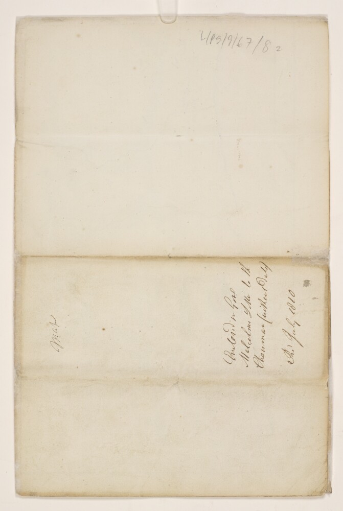
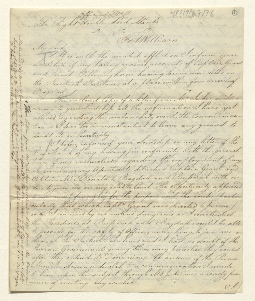
Abstract: A copy of a letter from Brigadier-General John Malcolm, Envoy of the Supreme Government of India to Persia [Iran], to Lord Minto, Governor-General of Bengal, sent from a camp near Shiraz and dated 10 May 1810, concerning route surveys on the frontiers of Persia ordered by Malcolm. The letter reports the death of Captain Grant and Cornet Fotheringham on the road from Baghdad to Isfahan [Eṣfahān]; and the arrival in Shiraz of Captain McDonald and Lieutenant Monteith from Bussora [Basra] across southern Persia.Physical description: 1 item (2 folios)
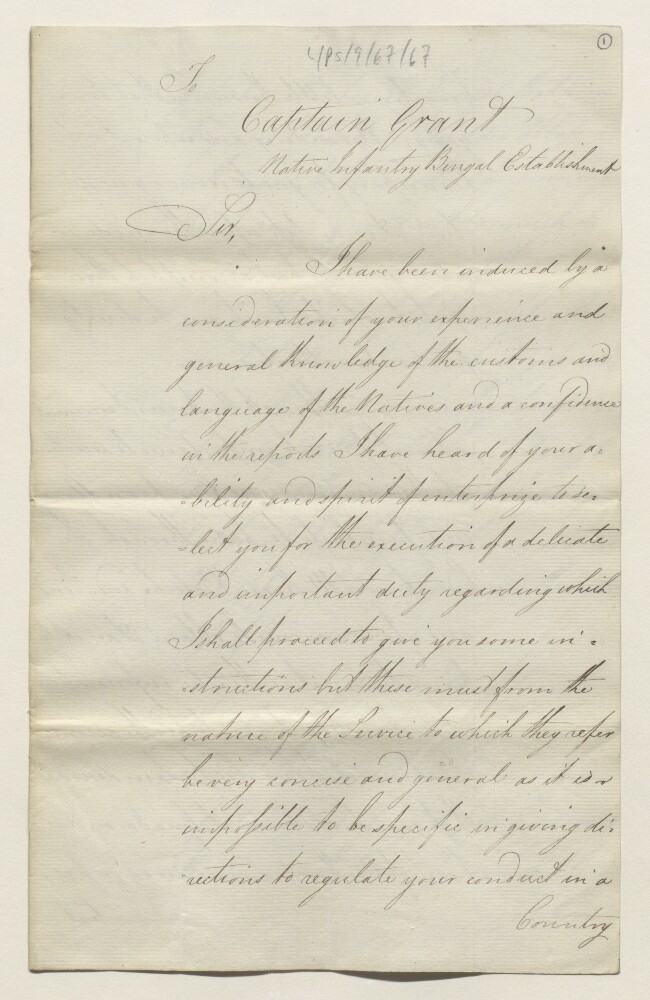
Abstract: A copy of a letter from Bridgadier-General John Malcolm to Captain Grant, Bengal Native Infantry, sent from Bombay [Mumbai] and dated 13 January 1809. The letter instructs Grant to proceed to Guada [Gwadar] and to travel from there across Mekran [Makrān] and Baloche [Balochistān] to Bunder Abbass [Bandar-e ‘Abbās], in order to collect information and assess the threat of an invasion of India by a European force using that route.Physical description: 1 item (8 folios)
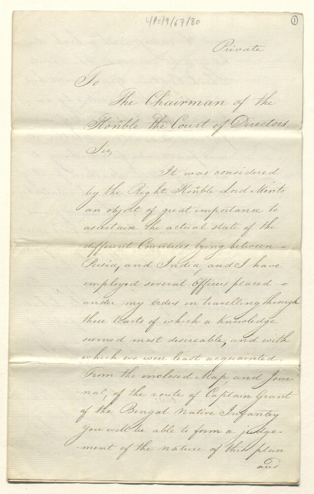
Abstract: A copy of a letter from Brigadier-General John Malcolm, Envoy of the Supreme Government of India to Persia [Iran], to the Chairman of the Court of Directors of the East India Company, received in July 1810. The letter concerns route surveys on the frontiers of Persia conducted on Malcolm’s orders, forwarding a map [IOR/L/PS/9/67/82] and journal [IOR/L/PS/9/67/81] of the journey of Captain Grant across Baloche [Baluchistān] and Mekran [Makrān], and assessing the threat of an invasion of India from this direction.Physical description: 1 item (4 folios)