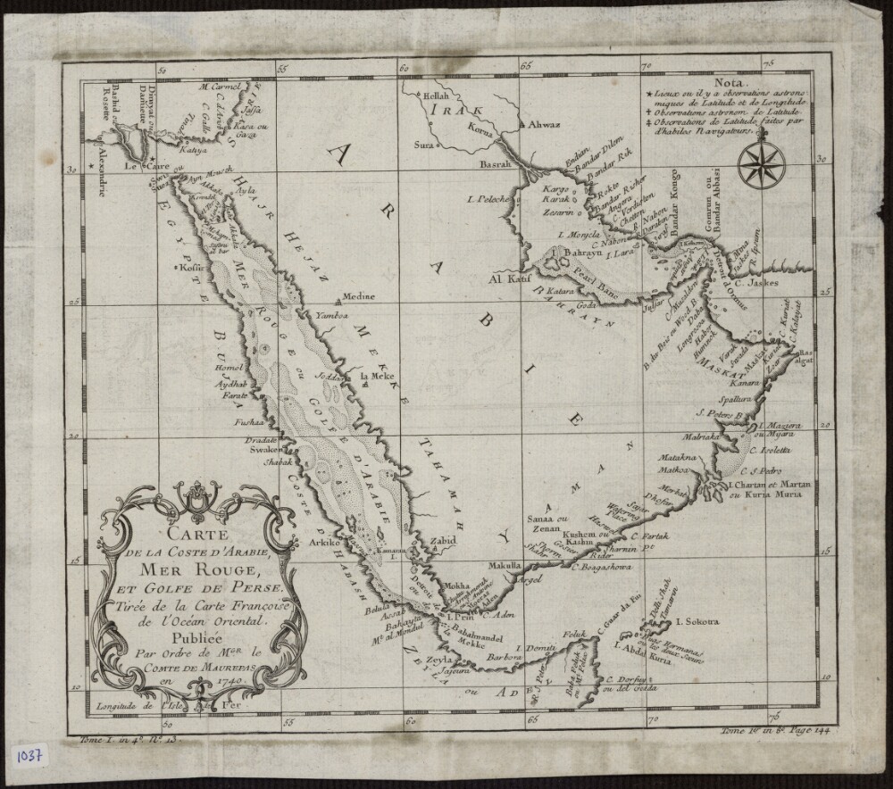
121. Map of the Coast of Arabia, the Red Sea and the Persian Gulf Date: 1740 Language: French Geographic region: المملكة العربية السعوديةالإمارات العربية المتحدةقطرالبحرينالكويتعماناليمنالعراق
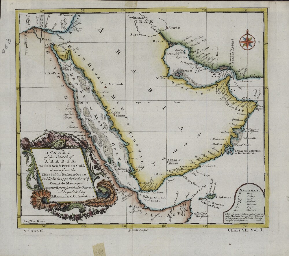
122. A Chart of the Coast of Arabia, the Red Sea and Persian Gulf, Drawn from the Chart of the Eastern Ocean Date: 1740 Language: English Geographic region: Iraq
123. Map of Ancient Arabia Date: 1720 Language: Latin Geographic region: نورمبرغالمملكة العربية السعوديةالإمارات العربية المتحدةقطرالبحرينالكويتعماناليمن
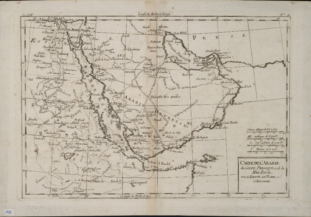
124. Map of Arabia, the Persian Gulf, and the Red Sea; Including Egypt, Nubia, and Abyssinia Date: 1780 Language: French Geographic region: المملكة العربية السعوديةإريترياإثيوبياالإمارات العربية المتحدةالسودانقطرالبحرينالكويت
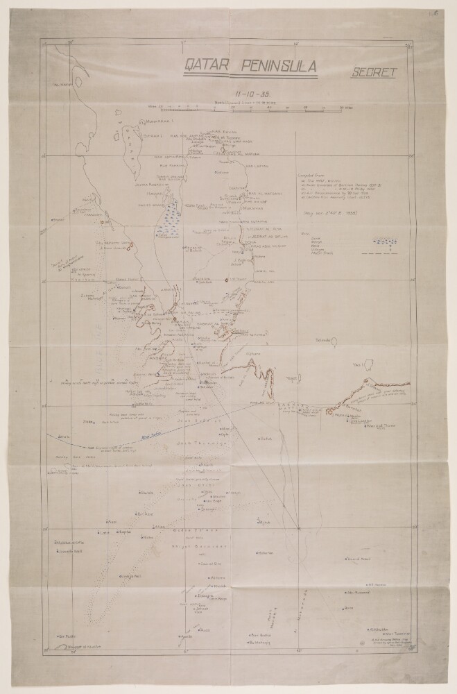
125. Map of the Qatar peninsula showing the concession boundary Date: 1937/1947 Language: English Geographic region: Qatar
126. Map of the South-Eastern Part of the Arabian Peninsula Date: 1900/1940 Language: English Geographic region: ArabiaAbu DhabiQatar
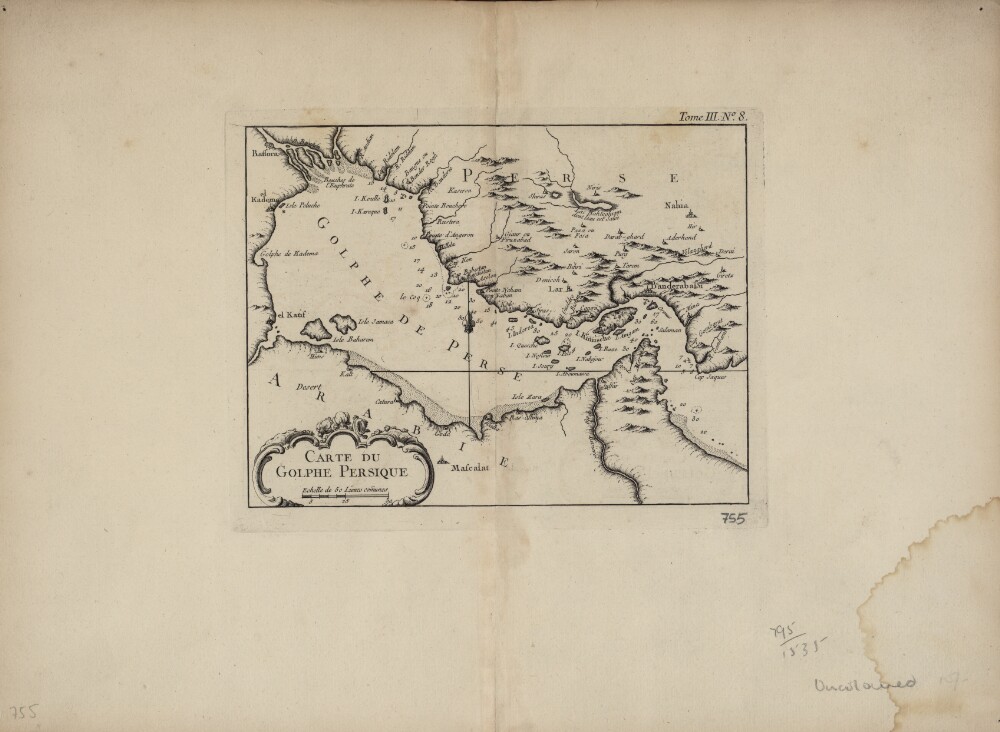
127. Map of the Persian Gulf Date: 1763 Language: French Geographic region: المملكة العربية السعوديةالإمارات العربية المتحدةقطرباريسالبحرينالكويتالجمهورية الإسلامية الإيرانيةعمان
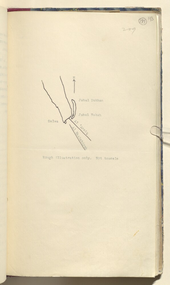
128. Rough sketch map showing Dawḩat Salwá Date: 1936/1936 Language: English Geographic region: QatarShatt al ʻArab
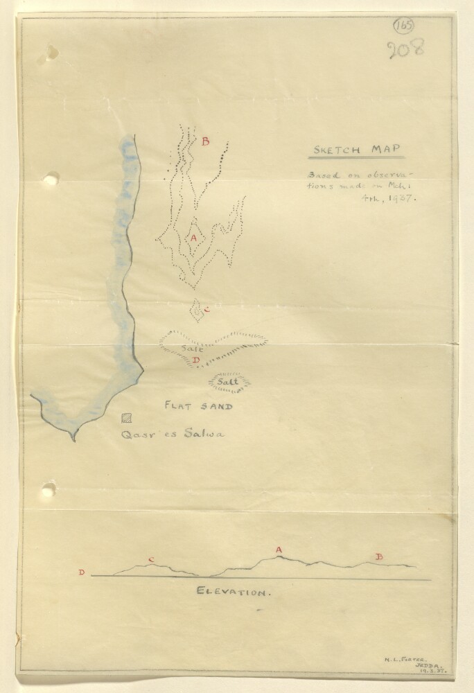
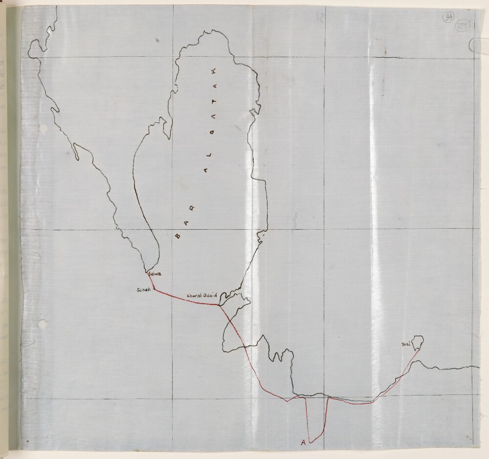
129. Sketch map showing area north of Qasr es Salwa, Qatar Date: 1937/1937 Language: English Geographic region: QatarShatt al ʻArab
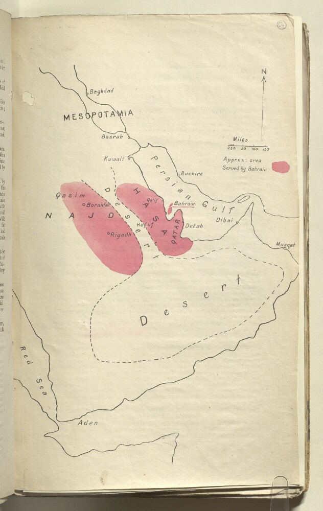
130. Sketch map showing approximate area served by Bahrain as a distributing port Date: 1918/1918 Language: English Geographic region: BahrainHasaNajdQatar
131. Sketch map of Qatar Peninsula Date: 1934/1934 Language: English Geographic region: QatarShatt al ʻArab
132. RAF sketch map of the Qatar Peninsula Date: 1935/1935 Language: English Geographic region: QatarShatt al ʻArabSaudi Arabia