1. '14/115 II B. 5. Abu Musa. Abu Musa oxide contracts and concession. Hassan Samaiyeh's dealings with the Germans.' Date: 1906/1907 Language: English Geographic region: Abu Musa IslandGermany
2. '14/115 III B. 6 Abu Musa; Hassan Samayeh's dealings with the Germans' Date: 1907/1908 Language: English Geographic region: Abu Musa IslandGermany
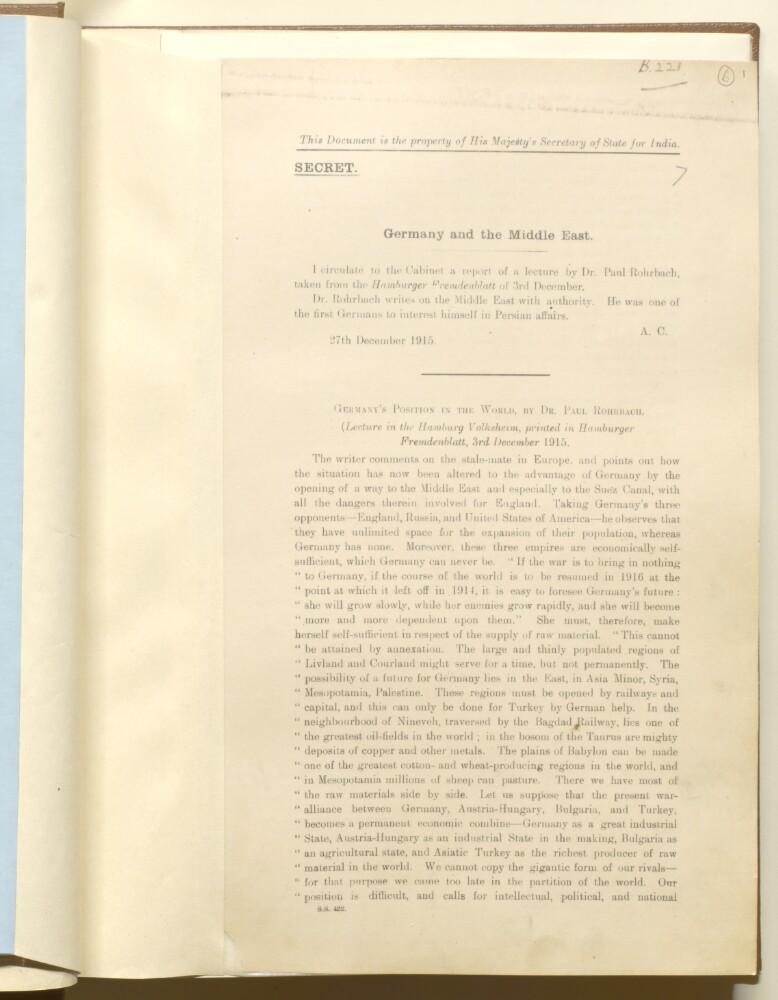
3. 'Germany and the Middle East' Creator: Author: Secretary of State for India, United Kingdom Date: 1915/1915 Language: English Geographic region: GermanySuez CanalTurkeyMiddle East
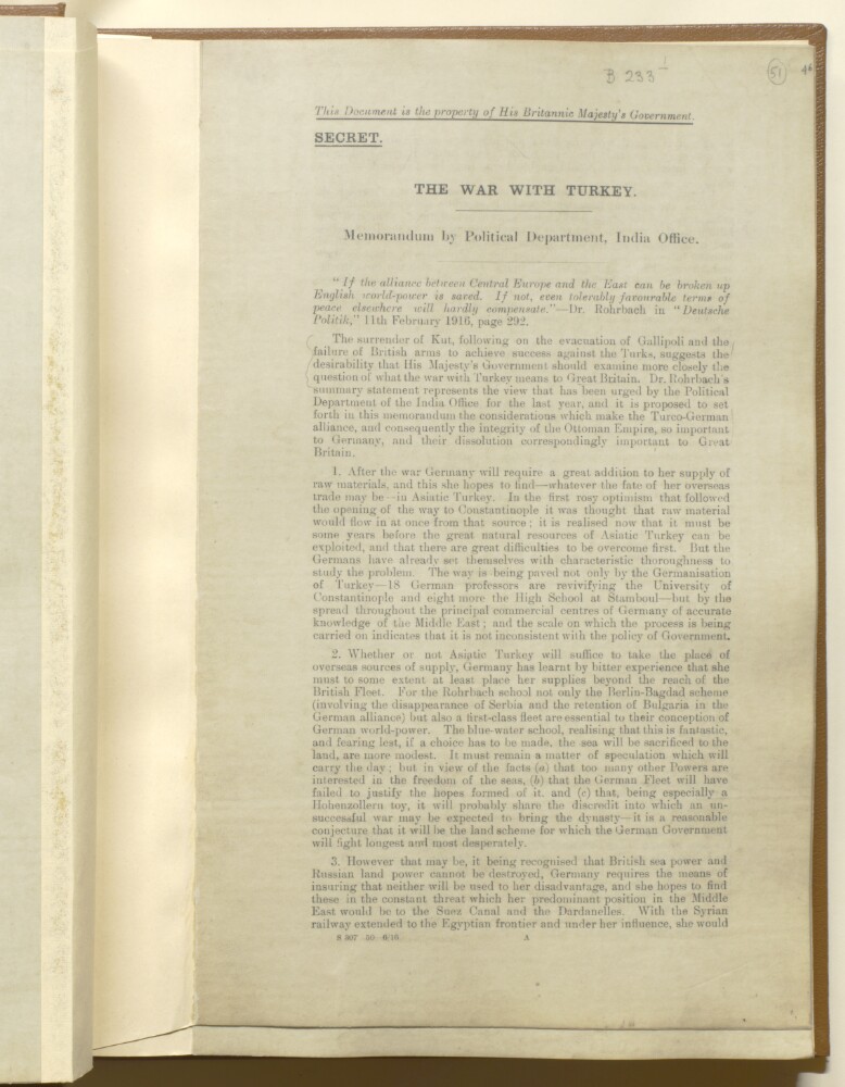
4. 'THE WAR WITH TURKEY. Memorandum by Political Department, India Office.' Creator: Author: India Office, Secretary to the Political and Secret Department Date: 1916/1916 Language: English Geographic region: GermanySuez CanalTurkeyOttoman Empire
5. 'Mesopotamia. Causes of unrest. Report No. II' Creator: Author: Norman Napier Evelyn Bray Date: 1920/1920 Language: English Geographic region: MesopotamiaSoviet UnionGermany
6. 'Memorandum by the Political Secretary, India Office, on German press opinion regarding the Middle East' Creator: Author: India Office, Secretary to the Political and Secret Department Date: 1916/1916 Language: English Geographic region: GermanyTurkey
7. 'Second memorandum, by the Political Secretary, India Office, on German press opinion regarding the Middle East. April and May' Creator: Author: India Office, Secretary to the Political and Secret Department Date: 1916/1916 Language: English Geographic region: GermanyTurkey
8. Charte der Laender am Caucasus nach den besten vorhandenen Creator: Reinecke, J. C. M. (Johann Christoph Matthias) Language: German Geographic region: WeimarCaucasus, SouthRussiaTurkeyGermany Extent: 1 map : hand col. ; 42 x 54 cm.
9. Die Balkan-Halbinsel in 4 Blättern Creator: Vogel, C. (Carl)Domann, E. Language: German Geographic region: GothaBalkan PeninsulaGermany Extent: 1 map : col. ; 84 x 66 cm.
10. Empire de la Porte ottomane en Europe, en Asie et en Afrique avec les pays qui lui sont tributaires Language: French Geographic region: AugsburgMiddle EastTurkeyEurope, SouthernAfrica, NorthGermany Extent: 1 map : hand col. ; 47 x 55 cm.
12. Karte des Bosporus und der Bithynischen Halbinsel Creator: Fitzner, RudolphTiedemann, J. G. (Johann Gottfried) Language: German Geographic region: Rostockİstanbul İli (Turkey)Kocaeli İli (Turkey)Sakarya İli (Turkey)Bosporus (Turkey)Germany Extent: 1 map : col. ; 47 x 87 cm.