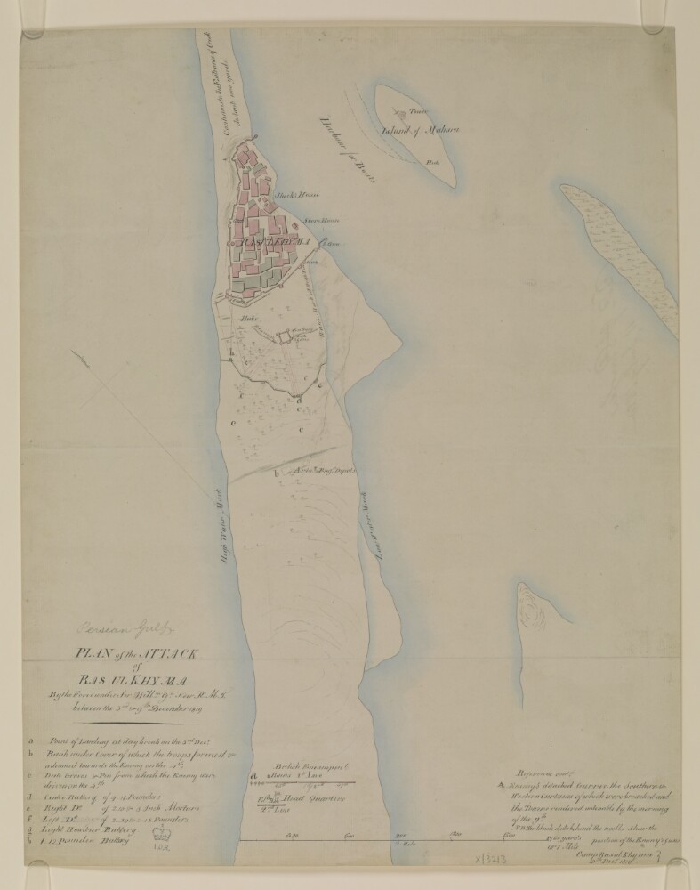
1. 'Plan of the attack of Ras Ul Khyma by the force under Sir Willm. Gr. Keir K.M.T., between the 3rd & 9th of December 1819’ Date: 1819/1819 Language: English Geographic region: Ra's al-Khaymah
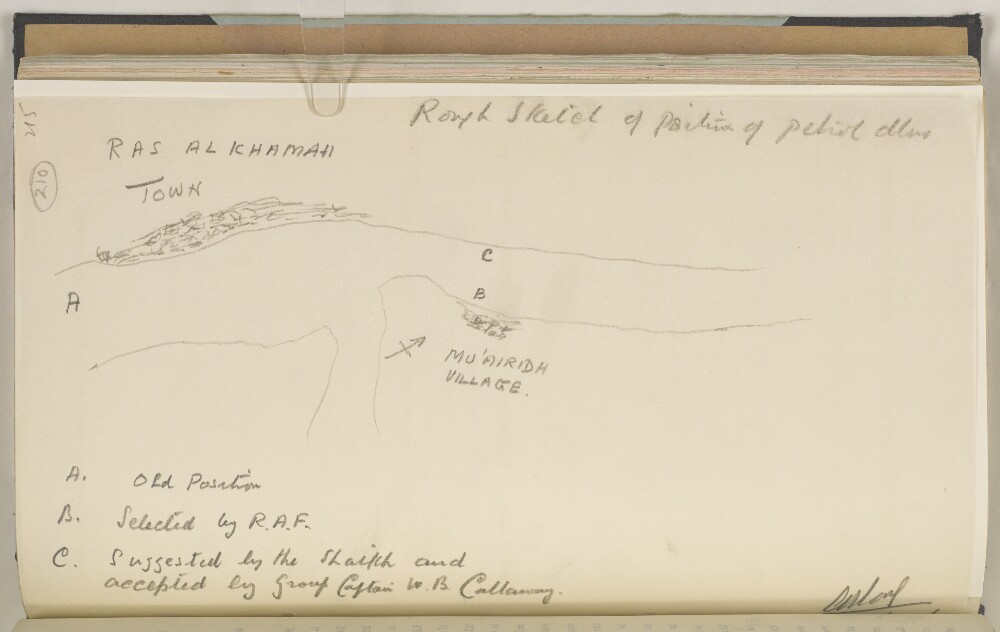
2. ‘Rough Sketch of Position of Petrol Dhow’ Date: 1937/1937 Language: English Geographic region: Ra's al-Khaymah
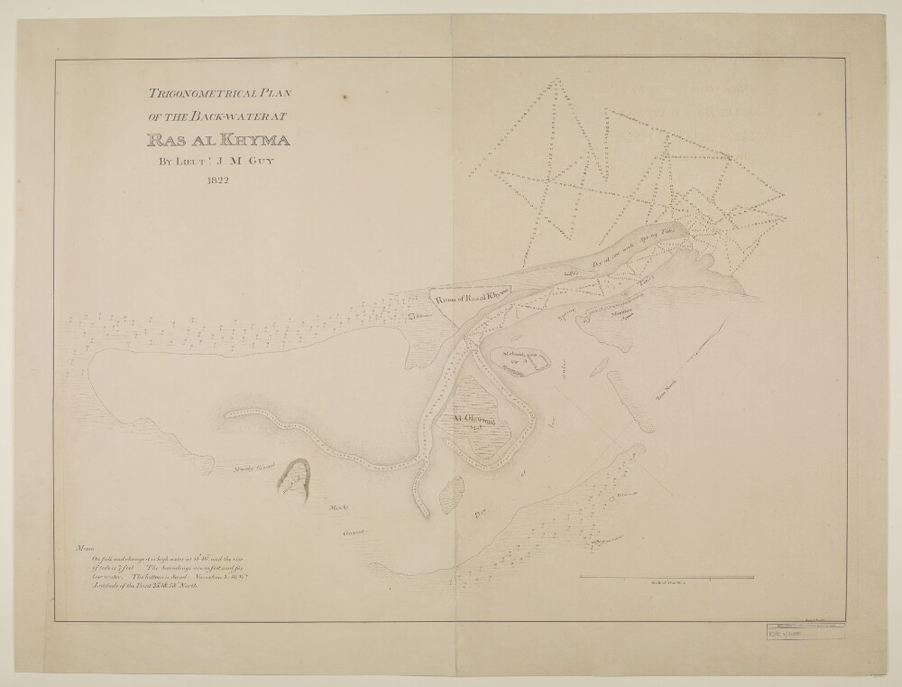
3. ‘Trigonometrical plan of the backwater at Ras Al Khyma. By Lieut. J.M. Guy, drawn by M. Houghton’ Date: 1822/1822 Language: English Geographic region: Ra's al-Khaymah
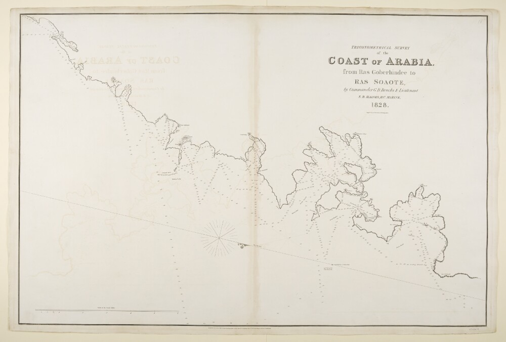
4. ‘Trigonometrical Survey of the Coast of Arabia, from Ras Goberhindee to Ras Soaote, by Commander G.B. Brucks & Lieutenant S.B. Haines, H.C. Marine, 1828. Engraved by R. Bateman, 85 Long Acre’ Date: 1832/1832 Language: English Geographic region: Ra's al-Khaymah
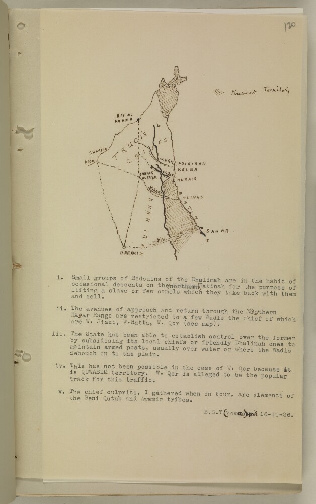
5. Sketch map of Ras al Khaima area Date: 1926/1926 Language: English Geographic region: Ra's al-Khaymah